 Metadados - GeoPortal / DF
Imagem 2016
Mosaico de Fotografias Aéreas do ano de 2016, baseada em 3.729 cenas em formato .TIFF, convertidas para JPG. Composição Colorida (RGB) na esca de 1:500, contendo pixel de 0,10x0,10cm. Obtidas de Camera Fotográficas Aerotransportada através de contrato com a Terracap. Georreferenciadas e Ortorretificadas.
Simple
Identification info
- Date (Creation)
- 2016-09-10
- Date (Revision)
- 2021-11-24
- Purpose
- Subsidiar o planejamento urbano
- Credit
- Diretoria de Geoinformações Territoriais e Urbanas - DIGEO
- Status
- Completed
Originator
Diretoria de Geoinformações Urbanas e Territoriais (DIGEO)
Setor Comercial Norte, Quadra 01, Bloco A - Edifício Number One - Asa Norte - Brasília/DF
Plano Piloto RA-PP
70711-900
Brasil
- Spatial representation type
- Grid
Spatial resolution
- Spatial resolution
- 0.24
- Topic category
-
- Imagery base maps earth cover
- Description
- Longitude Limítrofe Oeste 148010,00 m Longitude Limítrofe Leste 253027,00 m Latitude Limítrofe Norte 8284851,00 m Latitude Limítrofe Sul 8222744,00 m
N
S
E
W
))
- Keywords
-
- Imagem
- Imagens
- Mosaico
- Fotos aéreas
- Imagens aéreas
- Fotos
- Raster
- Dados Matriciais
- Language
- Portuguese
- Country
- Brasil
- Character encoding
- UTF8
Distribution Information
- OnLine resource
-
0
FOTO_2016
Data quality info
- Hierarchy level
- Service
Resource lineage
- Statement
- Imagem de levantamento aerofotogramétrico, sensor ótico, escala 500, realizado pela TOPOCART requerida pela TERRACAP. Cobertura aerofotogramétrica com GSD de 10cm. Composição colorida RGB e mosaico das imagens para cobertura do DF. Ortorretificadas de Georreferenciadas. Mosaico elaborado com bases em escalas fixas.
Spatial representation info
- Number of dimensions
- 2
- Dimension name
- Row
- Dimension size
- 1
- Resolution
- 0,1
- Dimension name
- Column
- Dimension size
- 1
- Resolution
- 0.1
- Cell geometry
- Area
Reference System Information
- Reference system identifier
- EPSG / 31983
mdb:MD_Metadata
- Metadata identifier
- urn:uuid / 287e5567-d561-4710-aaa5-b4dd73aeae11
- Language
- Portuguese
- Country
- Brasil
- Character encoding
- UTF8
Originator
Diretoria de Geoinformações Urbanas e Territoriais (DIGEO)
Setor Comercial Norte, Quadra 01, Bloco A - Edifício Number One - Asa Norte - Brasília/DF
Plano Piloto RA-PP
70711-900
Brasil
Type of resource
- Resource scope
- Service
- Metadata linkage
- http://www.metadados.seduh.df.gov.br/geonetwork/srv/api/records/ff91b5f1-8fe0-44b7-bd52-cec2c7661287
- Date info (Revision)
- 2022-11-17T15:57:30
- Date info (Creation)
- 2020-07-17
- Title
- ISO 19115-3:2014
- Title
- Perfil MGB 2.0
Overviews
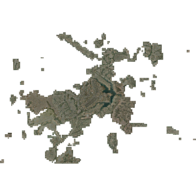
IMAGEM 2016
Spatial extent
N
S
E
W
Provided by

Associated resources
Not available